

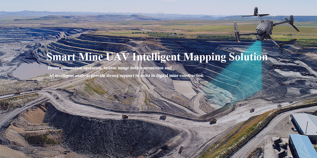
-The complexity and diversity of the terrain and the limited operating locations make it difficult for mapping to advance smoothly and effectively.
- There are safety hazards for personnel to carry out mapping under the pit.
- The existing equipment functions cannot be carried out continuously, making it difficult to collect complete data.
- Traditional operations under the data build time consuming, inefficient, slow results.
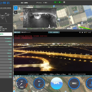
Drones operate automatically in areas with complex terrain to reduce the difficulty of mapping.
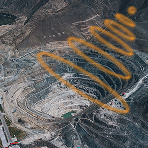
External environment perception + intelligent hangar + cloud operation, significantly improve operational efficiency.
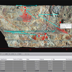
With diverse measurement devices, image data is transmitted in real time and intelligently identified.
With the corresponding software system, data management and analysis are realized.

Hotline:400-860-8819
Mailbox:support@wynnwheldon.com

Address: B604, building 4, 328 Xinghu street, Suzhou Industrial Park|1st floor, building 4, Lingang science and technology innovation center, 333 Haiyang 1st Road, Nanhui new town, Pudong New Area, Shanghai |Room 710, building 3, maiteng wisdom world, 1999 Jinxiu East Road, Pudong New Area, Shanghai
Address:B604, building 4, 328 Xinghu street, Suzhou Industrial Park
1st floor, building 4, Lingang science and technology innovation center, 333 Haiyang 1st Road, Nanhui new town, Pudong New Area, Shanghai
Room 710, building 3, maiteng wisdom world, 1999 Jinxiu East Road, Pudong New Area, Shanghai

